Penarth Dock, South Wales - the heritage & legacy . . .
Volume Five - The Age of Decline & Crass Stupidity - Some fools had cunning plans! . . .
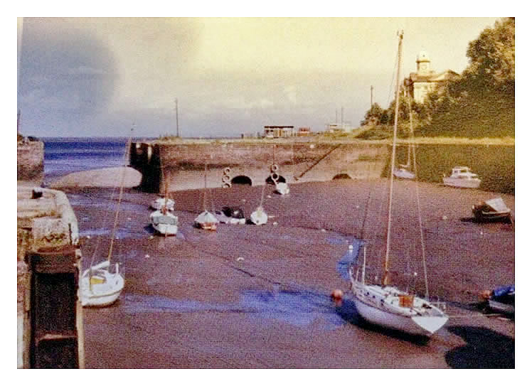
A view from about 1979 of the basin showing the mud bar and the level of the silt naturally deposited. The Penarth Times reported that the bar was a hazard only navigable at high tide. The silt by my estimation is about 25 feet deep at the quay wall considering that only the very top of the vaulted arch masonry is visible by this date. The image is a little discoloured but was kindly supplied by a forum member and is a useful record of the condition of the sea lock and basin at this time. [000][002]
A view from the early 1970's taken from the other side of the bund with the basin in use for mooring private boats. The basin is tidal by this date and distant is the derelict Customs House. Blue sky, I can believe but blue water never! The postcard is entitled "The Harbour, Penarth". Of course, its not the harbour, its the basin! [001][244]