Penarth Dock, South Wales - the heritage & legacy . . .
Volume Six - Pre-Victorian to the Present Day - Select Aspects - A closer look at the Cogan Pill . . .
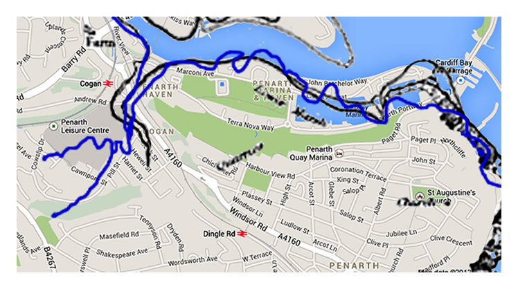
Key: black line = c.1830 OS map, the blue line = 1844 Geological Survey map, both outlines have been superimposed (best fit) upon the Google map of 2014 which shows a discrepancy in the route and extent of the Cogan Pill. [110][010][129]
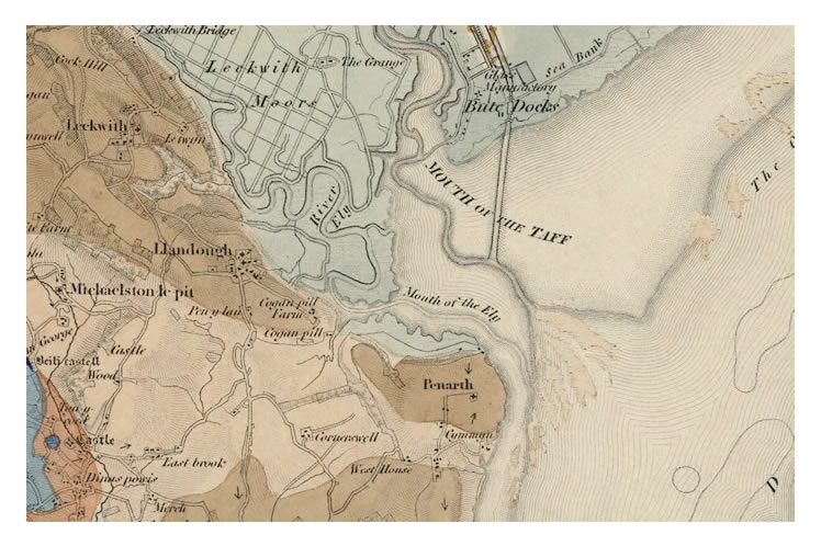
A section of 1844 Geological Survey Map which indicates Cogan Pill as an inlet with streams flowing into it. This detail was also included in maps published in 1833, 1852 and 1856. The pill at Cwtch-y-Cwm is less well defined that the OS map. [129]