Penarth Dock, South Wales - the heritage & legacy . . .
Volume Nine - Pre-Victorian to the present day - even more aspects - Radyr Stone . . .
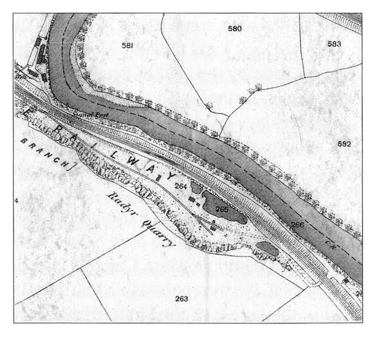
The 1:2500 scale OS plan of 1880, shows that at this time the quarry was around 380m in length and 75m at its widest point. It was accessed by a railway siding from the north-west which was about 275m long and forked into two 40m branches at the south-eastern end. A cart road gave access to the quarry under a railway bridge and terminated after about 150m close to the ends of the railway sidings. Parts of the south-western end of the quarry were flooded as evidenced by the presence of three ponds. There were five small rectangular structures within the quarry.[010][412][413]