|
|
Penarth Dock, South Wales - the heritage & legacy . . . |
|
|
Penarth Dock, South Wales - the heritage & legacy . . . |
 |
|||
 |
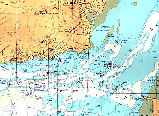
Volume Eight - Pre-Victorian to the present day - more aspects - A brief history of Trinity House lightvessels . . The chart below shows the locations of Trinity House lighthouses and lightvessels in the Bristol Channel from Breaksea Point west of Aberthaw over to the English coastline just up from Bridgewater Bay. It provides some indication of the complexity and dangers to shipping of the approaches to Penarth Dock. It also indicates the scale of the Trinity House operation around our coastline in the days before electronic navigation and satellite positioning systems. Their main depot for the area was at Swansea docks. Breaksea lightship location is clearly seen as are the channel isles of Flat Holm and Steep Holm. This chart is taken from the chart of the Bristol Channel published in December 1979. [297]
|
||
| Introduction | |||
| Contents | |||
| Search this site | |||
| Contributions | |||
| Links | |||
| Recent Updates | |||
|
|||
| | volume 08 | chapter 01 | page 070 | << previous page << | index to volume eight | >> next page >> | | |||
|
|||