Penarth Dock, South Wales - the heritage & legacy . . . |
Penarth Dock, South Wales - the heritage & legacy . . . |
|
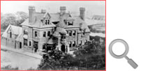
Volume Six - Pre-Victorian to the Present Day - Select Aspects - Growth and development at Cogan . . At the intersection of Pill Street and Windsor Road is the public house known as the Station Hotel, named because it was in close proximity to the Penarth Dock and Harbour Station of the TVR as well as the Cogan Station of the Barry Railway Co.. The hotel was known as "Top House" to the locals according to some historians, although Julie and Judith do not ever recall this name. An image of the hotel taken from the embankment shows the fine building and of especial interest is that in the background are the brick kilns of the Cogan Pill Brick Works.
The low lying area near the brickworks was prone to flooding since the Spring tide level often equalled that of much of the land. The meandering feature indicated in blue in the image above left is most probably a remnant of the Cogan Pill although most brick and tile works had a brick-pond or two. However, it does not seem to fit within the boundaries of the Pill indicated within either of the 1830 or 1833 OS maps; although we have to consider that nearly half a century has elapsed between the surveys. The entrance to the docks which dips through a tunnel under the Taff Vale Railway followed the line of the Pill. Embankments for the road and railway effectively sever the pill from the river which were probably generated by spoil dug from the dock construction or the excavation of the escarpment. A Topographical Dictionary of Wales by Samuel Lewis dating from 1833 describes :- |
||||||
| Introduction | ||||||
| Contents | ||||||
| Search this site | ||||||
| Contributions | ||||||
| Links | ||||||
| Recent Updates | ||||||
|
||||||
| | volume 06 | chapter 04 | page 01 | << previous page << | index to volume six | >> next page >> | | ||||||